
Family Friendly Off Grid Homesite with...

Featured offer!

For Sale, Land
Yucca, Arizona
Listing ID # 137 Parcel # 245-03-223

- 928-288-0556
- Send message
- All listings (26)
Get Property Updates

- Listing ID:
- 137
- Type:
- For Sale
- Property Status:
- Pending
- Property type:
- Land
- Land Size (Acres):
- 1.93
- Parcel #:
- 245-03-223
No payment options available at this time due to property status: Pending
Property status is subject to change, please check back for updates.
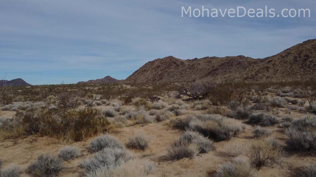
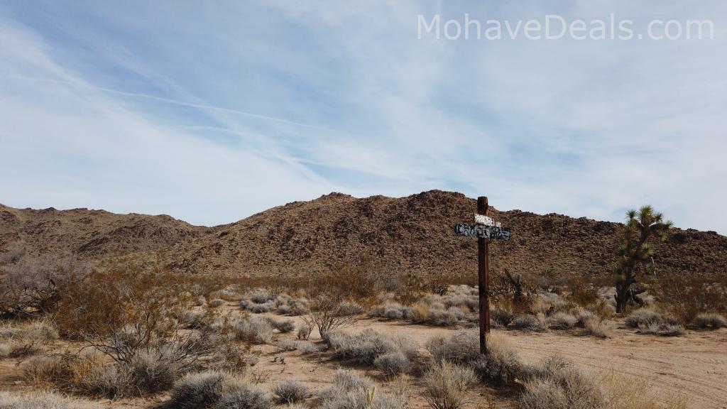
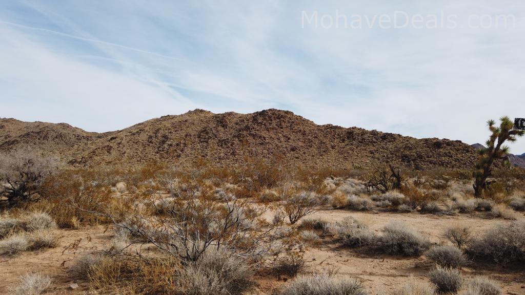
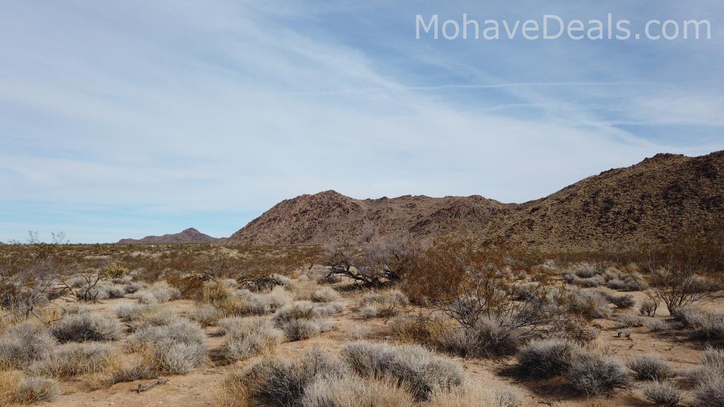
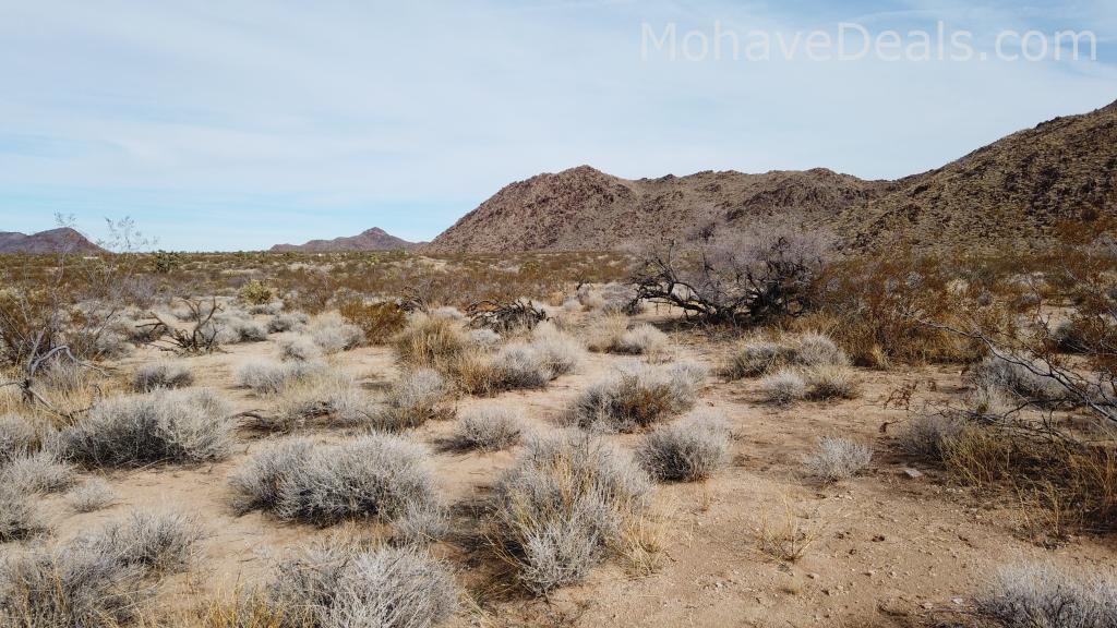
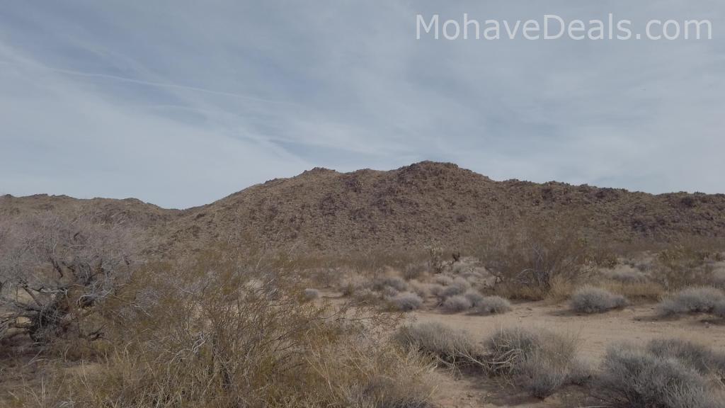
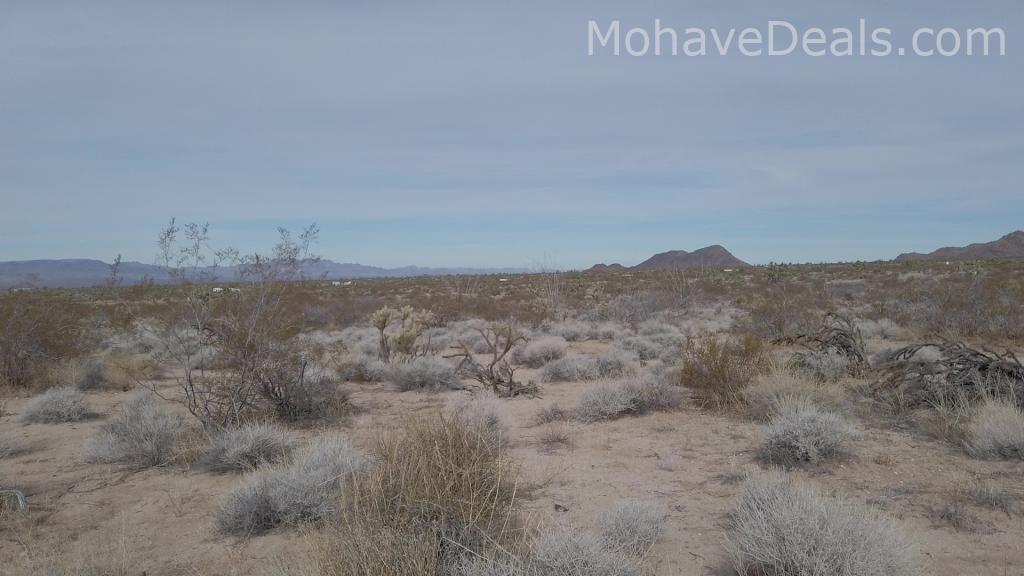
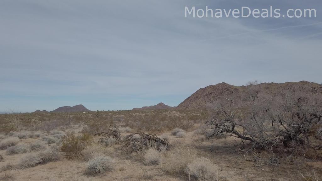
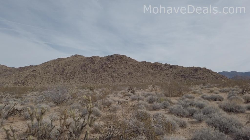
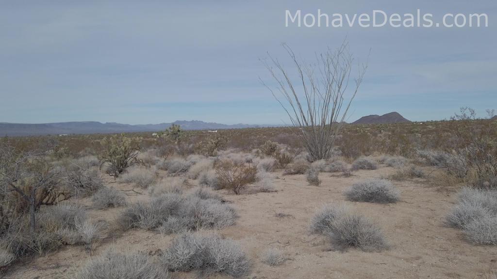
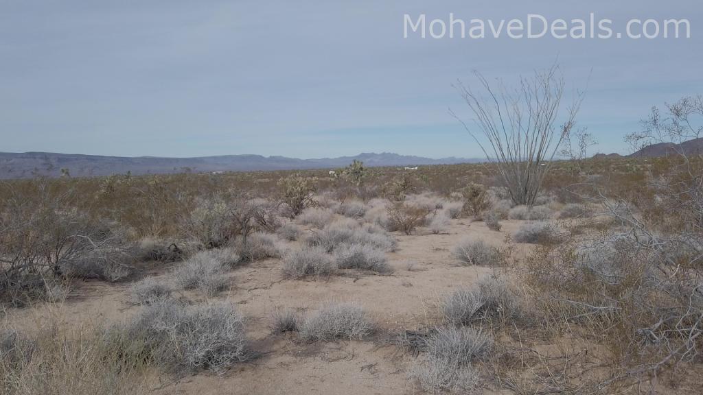
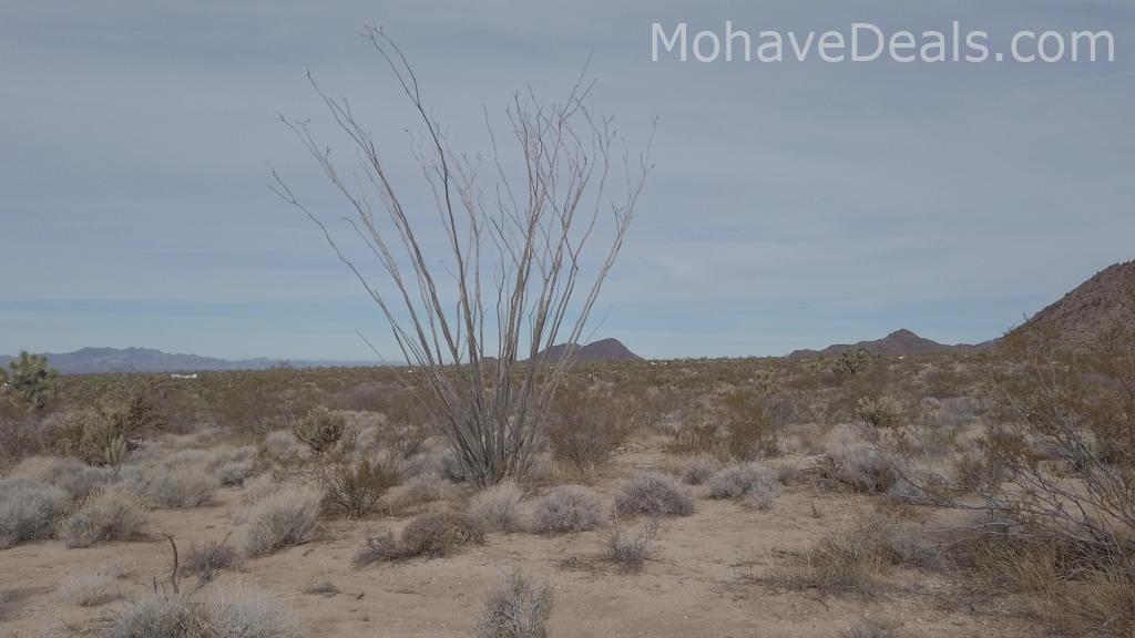
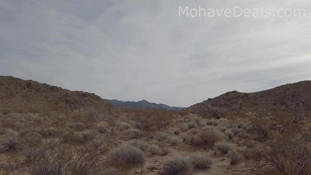
This lot sits in a VERY pretty area. It has easy access to the highway but is tucked away at the base of scenic foothills and is a beautiful corner lot that borders BLM land at both sides of the corner, so you will keep those beautiful unobstructed views with no neighbors!
Unlike many other land sellers, my family and I actually LIVE in this area. We care about this area and the future it holds, and care about the environment we live in. This area appeals to anyone looking to connect with nature, and exercise a bit of self-reliance and personal responsibility. Owning land is an investment in your future, a hedge against inflation, and for us it’s more than just a financial investment.
Feel free to call anytime to discuss, we’re happy to answer questions about the area and help you on the way to land ownership. Even if we don’t have exactly what you’re looking for maybe we can point you in the right direction. If there’s anything we can do to help, please don’t hesitate to ask.
If you would like to drive by this or any other property, please call or text first. Sometimes the most direct route is not the best route to get there, sometimes it's not even a good route to get to the property. When you call I can guide you to the easiest route to view any of our properties.

1.93 Acres

Arizona
Mohave County

Dirt Road

Available nearby / Wind or Solar
Water-Haul or Well

34.877847° N 114.056823° W

AR
OATMAN, ARIZONA
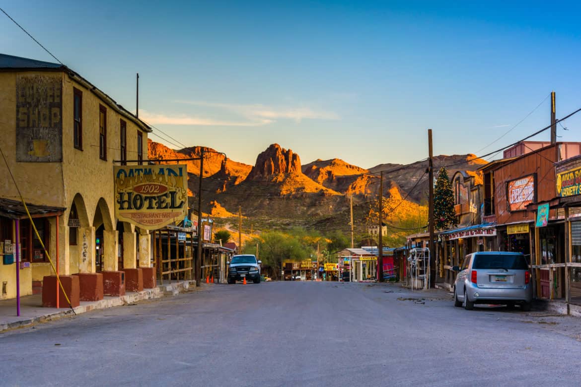
Oatman is a village in the Black Mountains of Mohave County, Arizona, United States, located at an elevation of 2,710 feet. It began as a small mining camp when two prospectors struck a million gold find in 1915. Now a nice Town to visit, get up close to wild burros, and see beautiful scenery along with all the little tourist shops. The drive along route 66 into Oatman is well known for it's breathtaking scenery.
LAKE MEAD
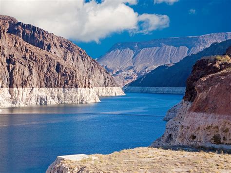
Lake Mead is a reservoir formed by the Hoover Dam on the Colorado River in the Southwestern United States. It is located in the states of Nevada and Arizona, 24 mi east from Las Vegas Strip. It is the largest reservoir in the United States. Great for swimming, boating, camping and more!
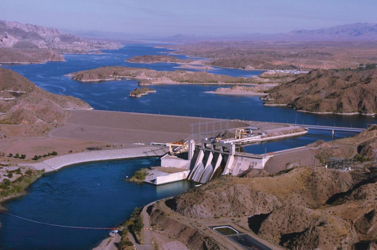
HOOVER DAM
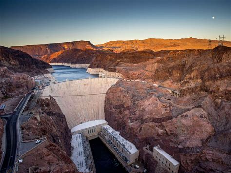
Hoover Dam is a concrete arch-gravity dam in the Black Canyon of the Colorado River, on the border between the U.S. states of Nevada and Arizona. It was constructed between 1931 and 1936. You can visit and stand in 2 states at one time.
LAS VEGAS

Or vegas for Short has a wide range of casinos, buffets, shows and is close to the many national parks.
DAVIS DAM
Davis Dam: Davis Dam is a dam on the Colorado River about 70 miles downstream from Hoover Dam. It stretches across the border between Arizona and Nevada. Originally called Bullhead Dam, Davis Dam was renamed after Arthur Powell Davis, who was the director of the U.S. Bureau of Reclamation from 1914 to 1923. Now a great place to spend the day with boat rentals and fishing.
THE LONDON BRIDGE
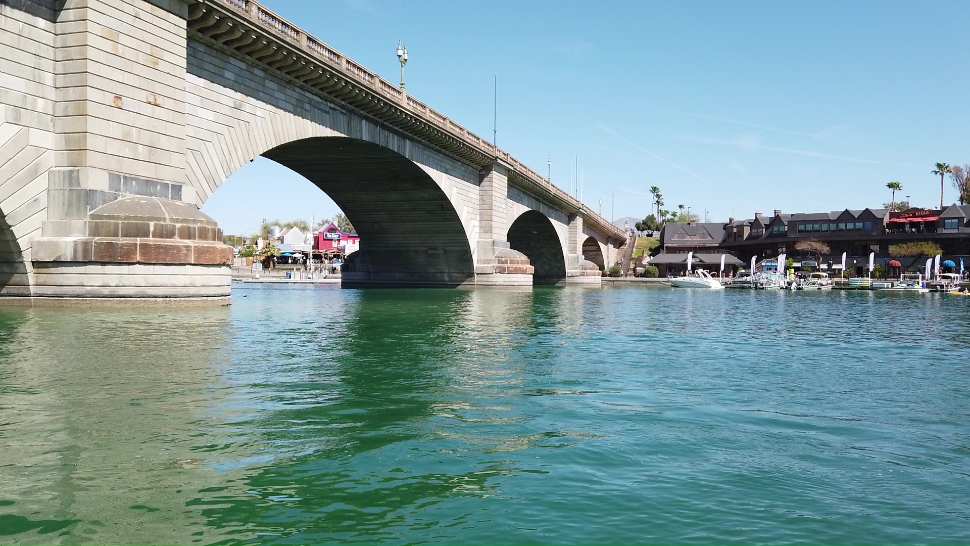
Yes! London Bridge is in Arizona, now located in Lake Havasu City, Arizona. It was originally built in the 1830s and formerly spanned the River Thames in London, England. The bridge was purchased by Robert P. McCulloch from the City of London in 1968. McCulloch had exterior granite blocks from the original bridge cut and transported to the United States for use in the construction of a new bridge in Lake Havasu City.
LAKE HAVASU
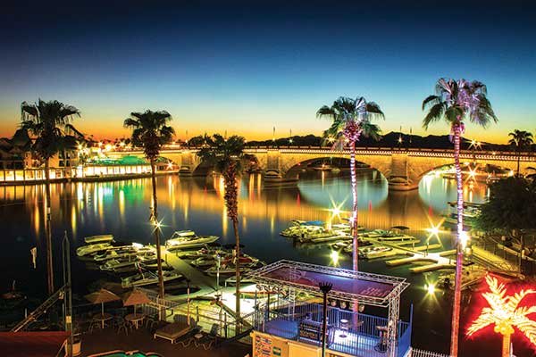
a planned community he established in 1964 on the shore of Lake Havasu.
TURQUOISE MINE
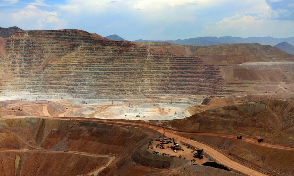
The Kingman Turquoise Mine is one of the oldest and highest producing Turquoise Mines in America. It was originally discovered by prehistoric Indians well over 1000 years ago. Kingman Turquoise is known for its beautiful sky blue color and produces many variations of blue Turquoise.
KINGMAN, AZ
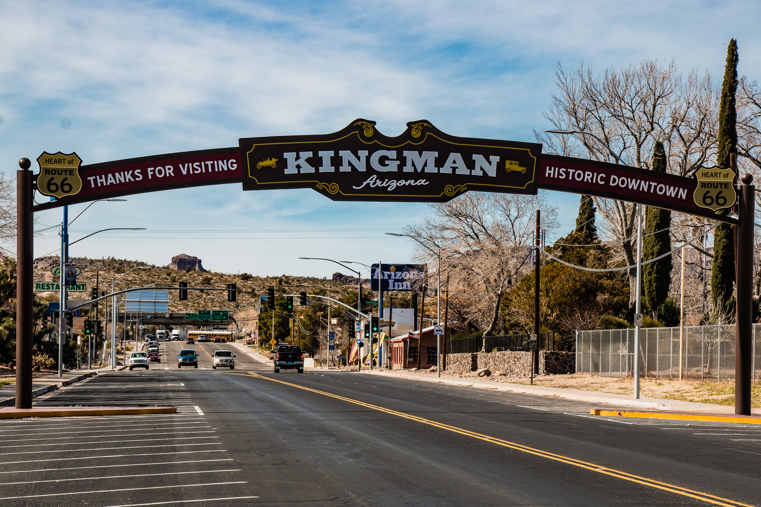
Kingman is a city in and the county seat of Mohave County, Arizona. Kingman is located approximately 105 miles southeast of Las Vegas. Also home of a great route 66 museum.
THE GRAND CANYON
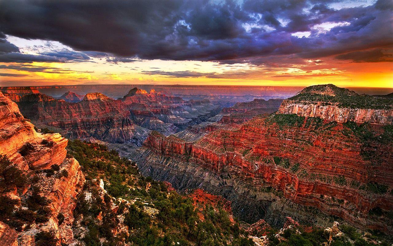
The Grand Canyon is a steep-sided canyon carved by the Colorado River in Arizona, United States. The Grand Canyon is 277 miles long, up to 18 miles wide and attains a depth of over a mile.
LAUGHLIN, NV

Laughlin is an unincorporated town and census-designated place in Clark County, Nevada, United States. It is located on the Colorado River, directly across from the much larger Bullhead City, Arizona. Laughlin lies 90 miles south of Las Vegas, in the far southern tip of Nevada. Known for it's shows and casinos on the river.
HAVASU NATIONAL WILDLIFE REFUGE
Havasu National Wildlife Refuge: The refuge protects 30 river miles and 300 miles of shoreline from Needles, California, to Lake Havasu City, Arizona. One of the last remaining natural stretches of the lower Colorado River flows through the 20-mile-long Topock Gorge.
HAVASUPAI FALLS
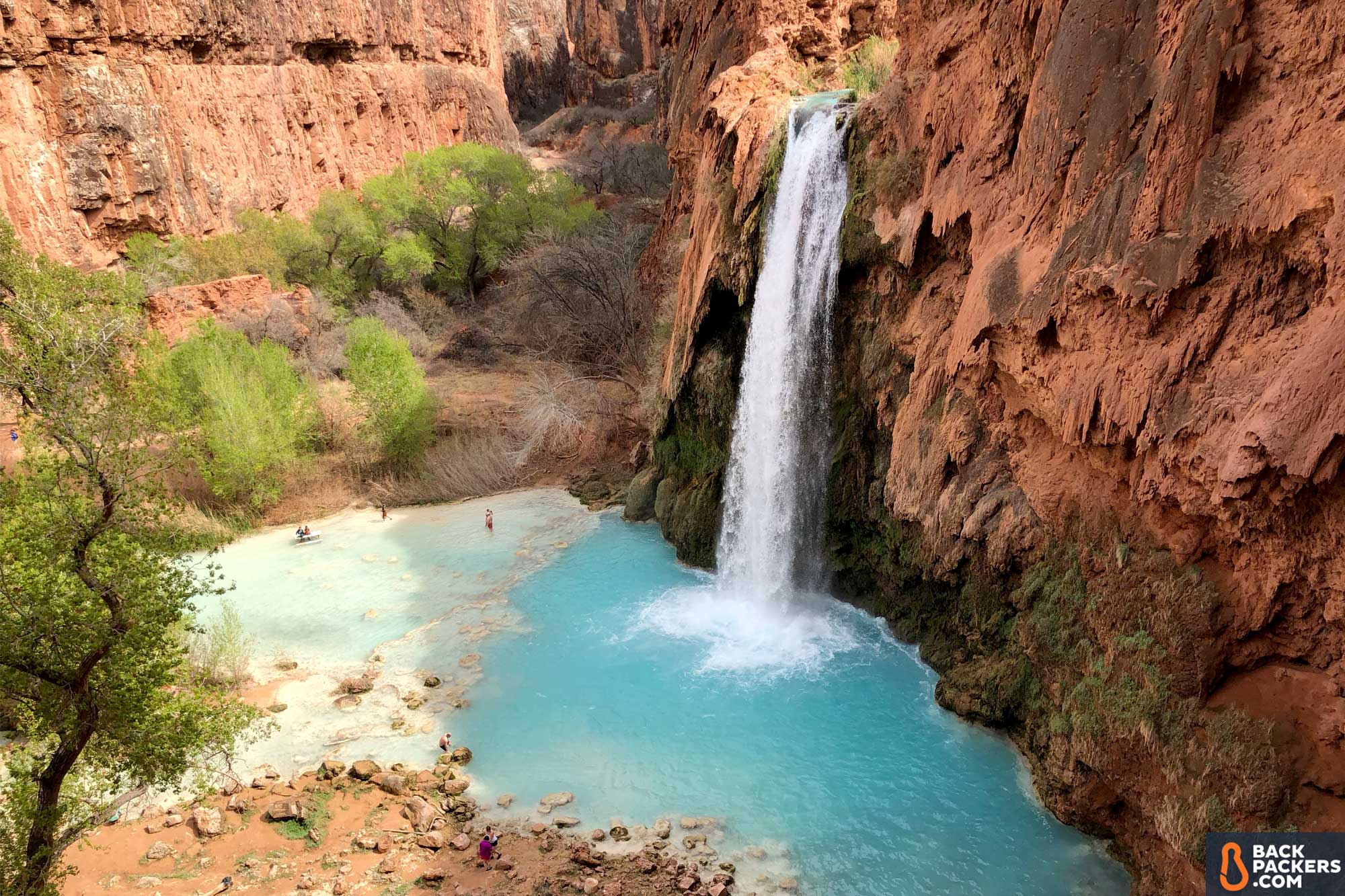
Havasupai Falls : Havasu Falls is the most famous of the aqua-blue Havasupai Waterfalls that spill over deep-orange, travertine cliffs in a desert oasis of stunning beauty. The stark contrast between the arid desert landscape of the Havasu Canyon and the lush vegetation near the water is a juxtaposition of harsh desert and a sumptuous tropical paradise. The five Havasupai Falls include: Navajo Falls, Fifty Foot Falls, Havasu Falls, Mooney Falls and Beaver Falls. All are located on the Havasupai indian reservation in a side canyon of the Grand Canyon. The waterfalls of the Grand Canyon are like no other in the world.
BIG BEND RECREATION AREA
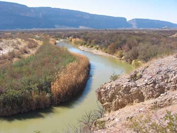
Nevada's newest state park, situated on the shores of the Colorado River below Laughlin in Nevada's southern tip. The park offers dramatic views of the river and surrounding mountains. Popular activities are picnicking, fishing, boating, and swimming. When completed, the park will also offer camping and hiking.The park is located five miles south of Laughlin on the Needles Highway.
UNION PASS
Union pass: State Route 68, also known as SR 68, is an East-West highway in northwestern Arizona running from its western terminus at its junction with State Route 95 in Bullhead City to a grade-separated interchange at U.S. Route 93 northwest of Kingman. The western terminus formerly extended just to the west of its current point to Davis Dam; this became Mohave County Road 68 in 1998
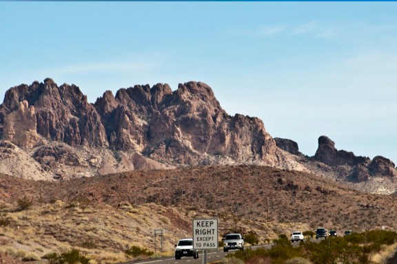
SITGREAVES PASS

Sitgreaves Pass is a gap at an elevation of 3,586 feet / 1,093 meters, in the Black Mountains of Mohave County, Arizona. windy roads of route 66. Breathing views of the mountains.
FISHBOWL SPRING
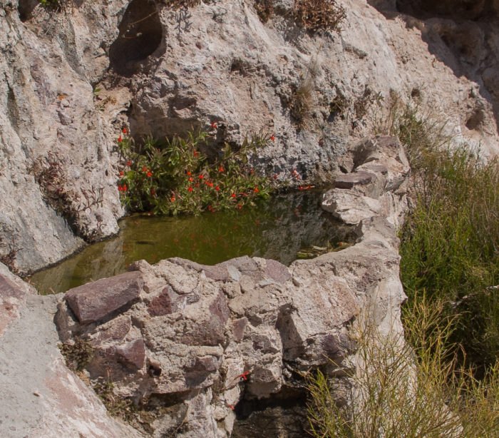
Fish bowl spring on route 66: Stairs to a natural spring with fish in it!. A unique stop on the way into or out of Oatman.